Geodynamics is Now NV5 Geospatial:
Geospatial Expertise from Marine to Mountain
By Sloan Freeman, Director of Hydrospatial Operations, NV5 Geospatial
Geodynamics has some exciting changes to share since the last time we were together at US Hydro! Please be sure to come by our booth to say hello to the new and expanded capabilities of Geodynamics and Quantum Spatial, as we have combined forces as NV5 Geospatial since 2021.
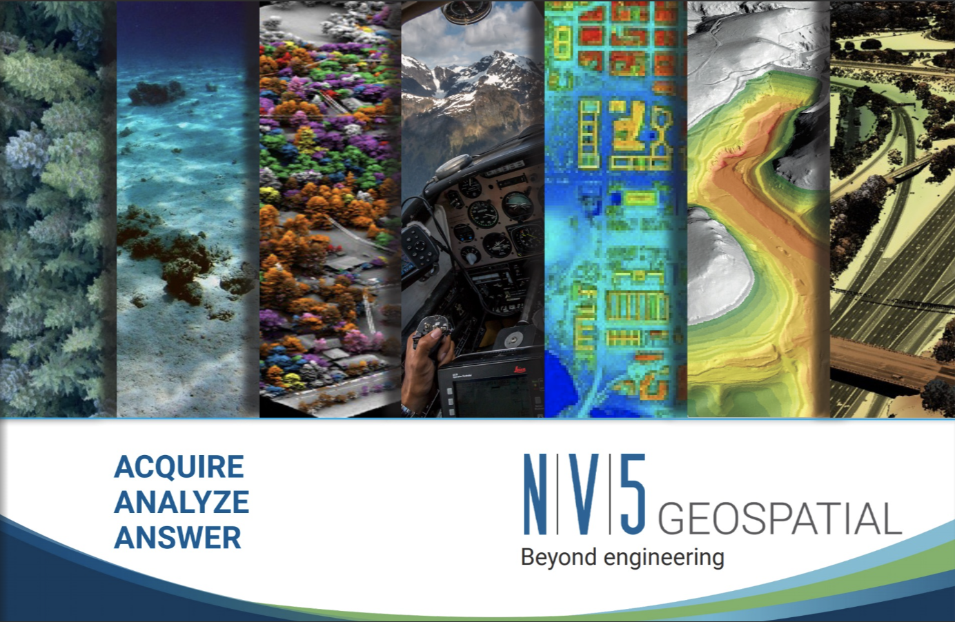
We’ve united the resources and technical expertise of both firms – adding Geodynamics’ sonar-based hydrographic and geophysical surveying to NV5 Geospatial’s aerial topographic and bathymetric solutions – to create an unparalleled ability to deliver detailed insights for coastal management, offshore assessments, flood modeling, and a variety of other applications. NV5 Geospatial pushes the boundaries to transform the way clients use and value geospatial data both offshore and on land.
NV5 GEOSPATIAL ONLINE BROCHURE (link: https://fliphtml5.com/yutcn/degu)
A Shared Standard of Excellence
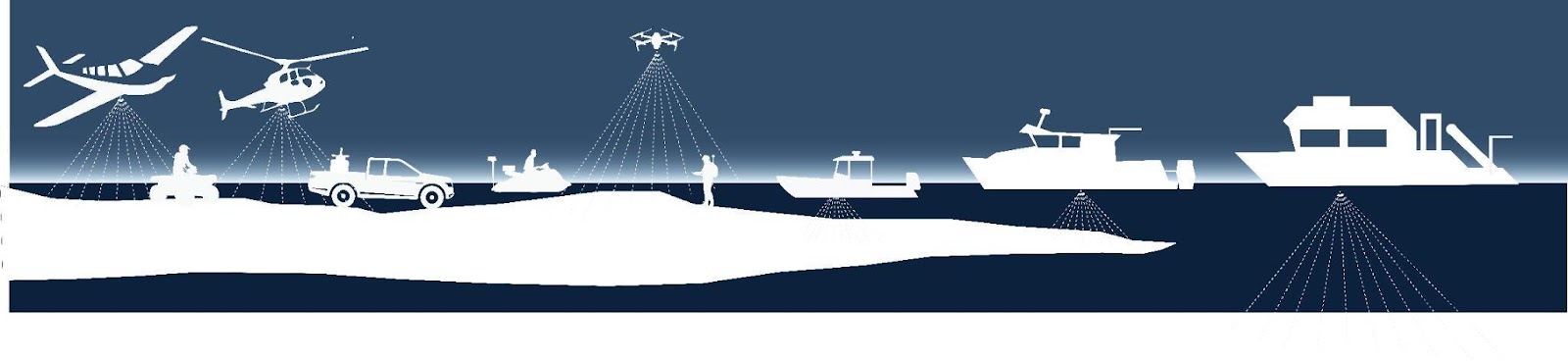
NV5 Geospatial has a long history of providing data acquisition, using cutting-edge technologies, including lidar, topobathymetric lidar, orthoimagery and hyperspectral imaging in some of the most challenging geographies around the country.
Geodynamics built its expertise in some of the most demanding coastal environments, including dynamic tidal inlets and the shallow coastal ocean. A pioneer in acquiring and processing multibeam and geophysical data in the nearshore environment, Geodynamics has prioritized reliable data accuracy through customized vessels, scientifically engaged personnel, and a deep commitment to quality control.
Building the Future
Backed by NV5, one of the nation’s largest engineering consulting firms, NV5 Geospatial is aggressively investing to create the future of coastal surveying. In the past year, we have grown in size by more than 40%, adding to our team of capable hydrographic and marine geophysical experts at Geodynamics. By integrating fully with the geospatial talent of NV5 Geospatial, we are also able to tap into a wealth of capacity and expertise to support data processing, analysis, and interpretation.
We are also evolving to meet the growing and changing demand for nearshore and offshore surveys to support coastal resilience and energy infrastructure. Building on Geodynamics’ existing fleet of capable survey launches, 2023 will see the introduction of two new research vessels unrivaled in their ability to conduct concurrent multi-sensor surveys from shoreline to shelf.
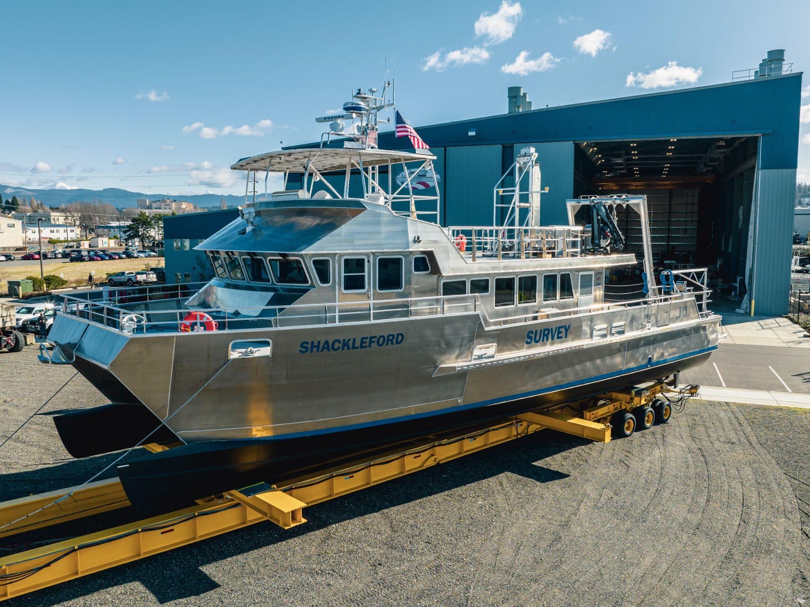
Both named for the coastal barrier islands that surround Geodynamics’ headquarters, the RV Shackleford is a 72’ All American Marine catamaran that has been designed specifically for site development and cable surveys. Supporting scientific & vessel crew safely for 12h or 24h operations, sensors can be deployed from a center retractable moonpool, a side-mounted pole, or from the large stern A-frame with twin hydraulic winches. RV Shackleford will be available for surveys in summer 2023.
The RV Bogue is a 58’ Kvichak catamaran customized for expanded client & PSO accommodation, comfortably supporting our data acquisition and processing team during 12h operations. The vessel boasts a massive rear working deck with rated A-frame and side-arm for towed arrays, and is available for surveys in spring 2023.
And finally, a recent retrofit of the RV Substantial (60’ Seaton Trawler) has yielded an exceptionally efficient mid-size survey vessel, bridging the gap between day-ops survey launches and extended duration vessels. With a hull-mounted multibeam, integrated Seakeeper, and comfortable accommodations for crew, the vessel has a stern A-Frame and side pole-mounts for additional gear.
Full Spectrum Capability
We are excited about the new projects we can undertake with our fleet of vessels and the collaboration between our marine unit and geospatial experts. Together as NV5 Geospatial, we will be able to solve our clients' greatest hydrographic challenges by mapping and analyzing environments from high mountain headwaters to the deep sea.
View Our Complete Marine Solutions Video
COASTAL MARINE SOLUTIONS (link: https://youtu.be/RGosb3RSQlQ)